
Published on: May 19, 2026
In the coastal villages of Senegal’s Casamance region, a silent crisis has been unfolding, threatening the vital mangrove ecosystems that serve as natural defenses against erosion and provide essential livelihoods for local communities. However, a groundbreaking initiative, leveraging advanced satellite technology through the Global Mangrove Watch (GMW) platform, is now empowering conservationists and local authorities to detect, understand, and address these threats with unprecedented speed and accuracy. The success stories emerging from areas like Séleki underscore the transformative potential of integrating remote sensing with on-the-ground action.
The Casamance, a lush and biodiverse area in southwestern Senegal, is characterized by its intricate network of rivers, estuaries, and extensive mangrove forests. These coastal wetlands are not merely scenic landscapes; they are critical ecological and economic assets. Mangroves act as natural barriers, absorbing the energy of storm surges and mitigating the impacts of rising sea levels, a growing concern in low-lying coastal zones worldwide. Furthermore, they are nurseries for a rich variety of marine life, supporting significant fisheries and providing valuable resources such as shellfish and honey, which are integral to the economic survival of thousands of people in the region.
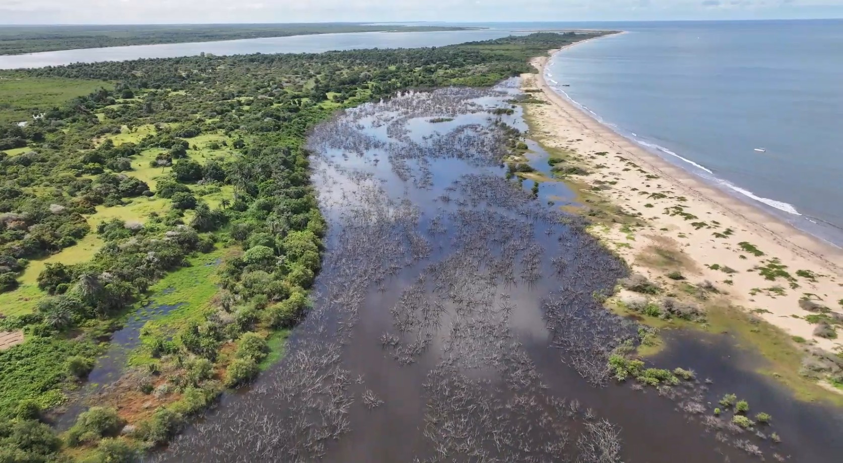
However, these invaluable ecosystems face multifaceted pressures. Historically, illegal logging for timber and fuel has been a primary driver of mangrove degradation. More recently, the expansion of aquaculture, agricultural practices, and infrastructure development have introduced new challenges, often leading to the alteration of natural water flows crucial for mangrove survival. Compounding these issues are the impacts of climate change, including increased salinity and unpredictable weather patterns. The vastness of the Casamance’s coastline and the limited resources of its dedicated rangers have historically made comprehensive monitoring a daunting, if not impossible, task.
The Dawn of Real-Time Monitoring: Global Mangrove Watch
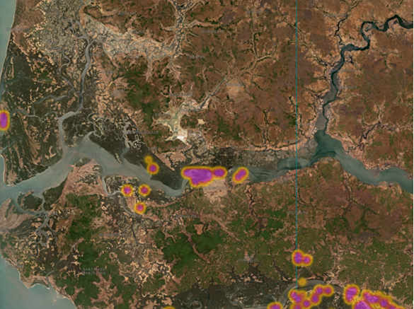
The Global Mangrove Watch (GMW) platform represents a significant leap forward in addressing this monitoring challenge. Developed through a collaboration of leading research institutions and conservation organizations, GMW utilizes a sophisticated combination of satellite imagery and advanced algorithms to provide near real-time data on mangrove cover and health. This innovative tool allows for the rapid detection of changes, alerting stakeholders to areas experiencing degradation or loss.
The alert system functions by analyzing changes in satellite imagery over time, flagging discrepancies that may indicate deforestation, damage, or significant environmental shifts. These alerts are then disseminated to designated local teams, enabling them to investigate the reported changes swiftly. This proactive approach shifts conservation from a reactive, often delayed, response to a targeted and timely intervention.

Séleki: A Case Study in Rapid Response and Community Collaboration
One of the most compelling examples of GMW’s impact comes from the village of Séleki, situated within the UKB Marine Protected Area (Ufoyaal Kassa-Bandial) in the Casamance. In May 2026, GMW’s alert system flagged the disappearance of approximately two hectares of mangrove forest in the Séleki area. This was not the result of visible logging, but a more insidious form of degradation.
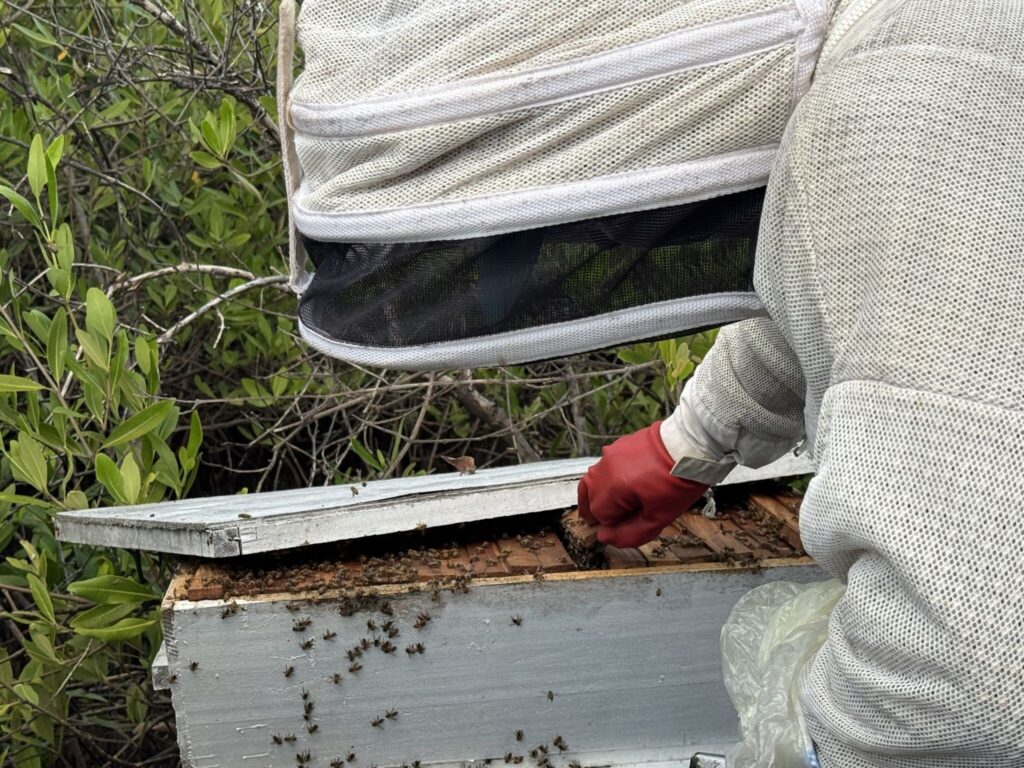
Upon receiving the alert, a local team comprising Boubacar Sagna and Khadim Diop, working under the auspices of Wetlands International, alongside Capitaine Agustin Sadio, an officer of the Marine Protected Area, immediately mobilized to investigate the site. Their on-the-ground assessment revealed the root cause: the construction of dikes.
Understanding the Cause: Dikes and the Disruption of Natural Flows
The dikes in Séleki had been erected to create ponds for aquaculture. While seemingly a means of economic development, these structures had a devastating unintended consequence. By blocking the natural ebb and flow of brackish water, the dikes deprived the mangrove roots of the tidal inundation essential for their survival. Mangrove species are uniquely adapted to saline, waterlogged environments, and their life cycles are intrinsically linked to the rhythmic pulse of the tides. The artificial barrier effectively suffocated the ecosystem, leading to the gradual withering and death of the mangroves.
This situation in Séleki highlights a critical challenge in coastal zone management: the potential for well-intentioned development projects to inadvertently harm vital natural resources. The conflict between aquaculture expansion and mangrove preservation is a recurring theme in many coastal regions globally, often driven by a lack of integrated planning and an underestimation of the ecological services provided by intact mangrove ecosystems.
Rooted Resilience Project: Empowering Local Conservation
The work in Séleki is part of Wetlands International’s broader "Rooted Resilience" project, generously supported by The Swedish Postcode Lottery Foundation. A key component of this project has been the training of various stakeholders in the Casamance, including local authorities, community members, and students, on how to effectively utilize the Global Mangrove Watch platform.
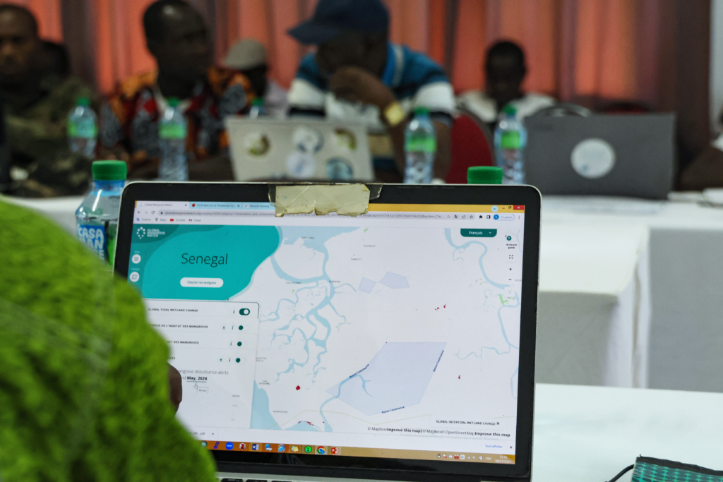
This capacity-building initiative equips rangers and conservation officers with the tools to monitor their vast areas of responsibility efficiently. Instead of spending valuable time on extensive, often fruitless patrols, they can now focus their limited resources on areas identified by GMW alerts. This allows for more targeted interventions, such as investigating the cause of degradation, engaging with local communities, and implementing restoration strategies. The ability to pinpoint specific degradation sites enables a more strategic allocation of limited conservation budgets and personnel, maximizing their impact.
Beyond Séleki: A Multifaceted Threat Landscape
The challenges facing the Casamance mangroves are not confined to Séleki. GMW has provided critical alerts in other Marine Protected Areas within the region, revealing a diverse range of threats:
Kalone-Bliss Kassa (KBK) Marine Protected Area: Natural Phenomena and Shifting Coastlines
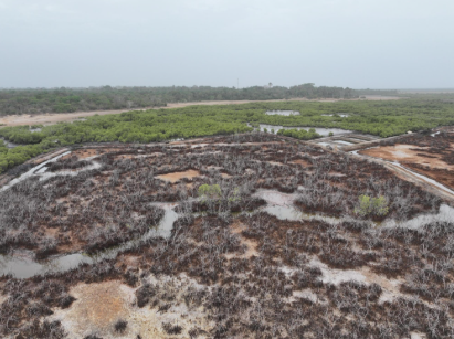
In the KBK Marine Protected Area, GMW detected a significant loss of approximately 16 hectares of mangroves. Unlike the situation in Séleki, this degradation was attributed to a natural phenomenon: the shifting of a large sand dune. This dune had effectively acted as a natural dam, cutting off the vital inflow of water necessary for the health of the mangrove forest. This incident serves as a potent reminder that even within designated protected areas, mangrove ecosystems are vulnerable to the dynamic forces of coastal geomorphology and climate-induced changes in sea level and sediment transport. The KBK area is a crucial habitat for numerous bird species, including cormorants and egrets, underscoring the ecological significance of these threatened mangroves. An impact study is currently underway to assess the potential outcomes of various intervention strategies to address this natural impediment.
Niamone-Kalounayes Marine Protected Area: Human Activity and Unclear Motivations
A third alert from GMW was registered in the Niamone-Kalounayes MPA, indicating clear evidence of mangrove cutting. While the physical removal of mangroves was undeniable, the precise reasons behind the cutting remain unclear. Potential motivations could include the harvesting of wood for fencing agricultural plots, a common practice in many rural areas to protect crops from wildlife, or for direct use as fuel or for crafting local products. The ambiguity surrounding the intent behind these actions makes it difficult to ascertain their legality. However, the alert has prompted the MPA to intensify its patrolling efforts in the area, aiming to prevent further degradation and to gather more information on the activities occurring within the protected zone. The proactive patrol response demonstrates how GMW alerts can directly influence and strengthen enforcement activities.
Implications for Sustainable Livelihoods and Community Engagement
The story of Séleki is not just about environmental restoration; it is intrinsically linked to the well-being of the communities that depend on these ecosystems. Wetlands International Afrique is actively facilitating dialogue between the Séleki community, the National Aquaculture Agency, and the owner of the dikes. The objective is to collaboratively develop alternative, sustainable livelihood strategies that do not compromise the health of the mangrove ecosystem.
This approach emphasizes finding new avenues for food security that are compatible with, rather than detrimental to, the natural environment. The goal is to eventually reopen the dikes, allowing the natural tidal rhythms to return and the ecosystem to begin its healing process. This aligns with the principles of Community-Based Ecological Mangrove Restoration (CBEMR), a methodology that involves working directly with local communities to recreate the conditions necessary for natural mangrove regeneration. Such approaches not only restore ecological functions but also empower communities to become stewards of their natural resources.
The success of alternative livelihoods, such as harvesting mangrove honey from restored areas, as demonstrated by the "Rooted Resilience" project, offers a tangible vision for a future where economic development and environmental conservation are mutually reinforcing. These initiatives provide local populations with economic incentives to protect and restore mangroves, creating a powerful synergy for long-term sustainability.
The Path Forward: Integration and Collaboration
The success of the Global Mangrove Watch platform in the Casamance region exemplifies a crucial paradigm shift in conservation. By merging the power of satellite technology with the invaluable knowledge and commitment of local communities and government agencies, a more effective and efficient approach to mangrove protection is emerging.
The journey from a digital alert to a thriving mangrove forest is often a long and complex one, involving intricate ecological processes, socio-economic considerations, and policy interventions. However, in places like Séleki, the initial steps toward recovery have already been taken, offering a beacon of hope for the communities and the invaluable ecosystems they rely upon. The ongoing efforts in the Casamance serve as a testament to the power of innovation and collaboration in safeguarding these critical coastal habitats for future generations. The ability to detect subtle changes from space, coupled with dedicated on-the-ground action and community engagement, offers a robust framework for tackling the complex challenges of mangrove conservation in a rapidly changing world.
