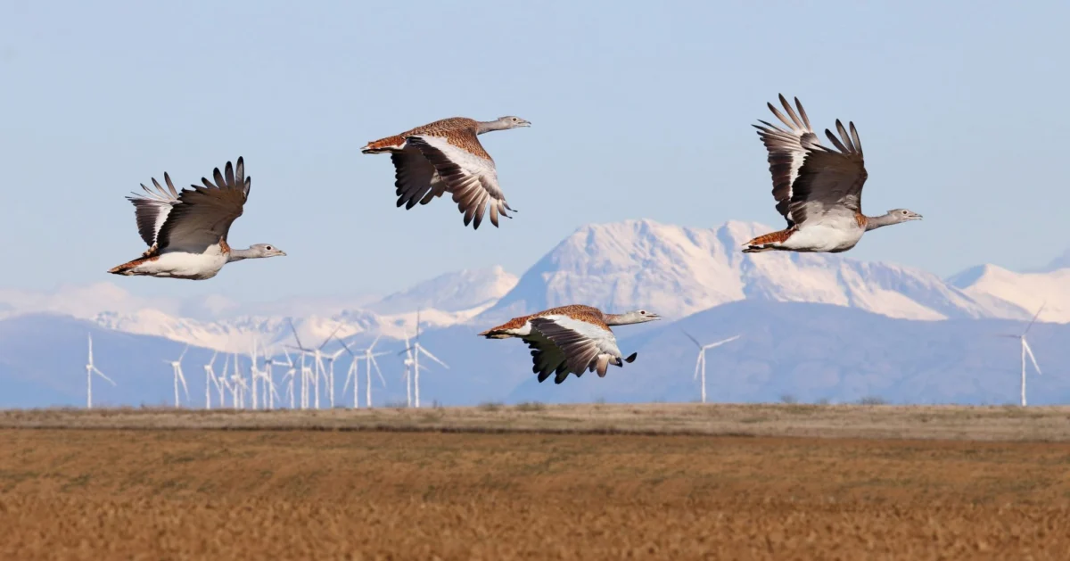
The urgent imperative to combat climate change through rapid deployment of renewable energy sources presents a complex challenge: balancing the need for ecological preservation with the accelerating transition away from fossil fuels. While wind and solar power are vital for preventing ecological collapse, their development must be meticulously planned to avoid unintended harm to wildlife, particularly vulnerable bird populations and their critical habitats. The most effective and economically sound strategy to mitigate the impact of renewable energy infrastructure, such as wind turbines, on avian life is to site these installations strategically, far from sensitive species, vital breeding grounds, and major migratory corridors. This proactive approach minimizes adverse effects or makes them significantly easier to mitigate.
Pioneering the Path: The Rise of Avian Sensitivity Mapping
In response to this critical need, sensitivity maps – sophisticated spatial tools designed to identify areas unsuitable for development – are gaining significant traction across both the renewable energy industry and governmental bodies. BirdLife International and its extensive network of partners have been at the forefront of developing and refining these indispensable tools. Historically, the Avian Sensitivity Tool for Energy Planning (AVISTEP) was a groundbreaking innovation, initially concentrating its efforts on regions within Africa and Asia. Recognizing the global applicability and urgent European context, BirdLife’s European Partners have since meticulously adapted the AVISTEP methodology, integrating local data to create highly detailed national sensitivity maps tailored to specific ecological and geographical contexts.

The European Union, driven by ambitious climate targets outlined in initiatives like REPowerEU and the Fit for 55 package, is currently engaged in a determined race to designate Renewable Acceleration Areas (RAAs) across both terrestrial and marine environments. These RAAs are intended to fast-track renewable energy development. However, without robust ecological considerations, these areas risk exacerbating biodiversity loss. Sensitivity maps serve as a crucial, science-based instrument, empowering Member States to undertake strategic spatial planning that minimizes environmental impact, ensuring that the energy transition supports, rather than undermines, biodiversity goals. The integration of such maps into national planning frameworks is essential for achieving a truly sustainable energy future.
Real-World Impact: Spain’s Proactive Stance and Portugal’s Adaptive Planning
The practical application and profound influence of avian sensitivity maps are perhaps best exemplified by the pioneering work in Spain and Portugal. Our Spanish Partner, SEO/BirdLife, has been a leading voice in this field since the nascent stages of wind farm development in the Strait of Gibraltar, particularly around Tarifa, in the 1990s. This region is globally recognized as a critical bottleneck for migratory birds traversing between Europe and Africa, making it exceptionally sensitive to human infrastructure. In its early days, SEO/BirdLife was unafraid to challenge projects that threatened areas of high ecological value, often resorting to legal action against developments planned or constructed in locations that would imperil sensitive avian species.
Building on this legacy of advocacy, SEO/BirdLife has proactively developed comprehensive bird sensitivity maps for onshore wind, offshore wind, and solar photovoltaic installations across Spain. These maps embody the foundational principle of the mitigation hierarchy: avoidance. By identifying and highlighting ecologically important zones before any development commences, they effectively prevent harmful projects from being initiated in biodiversity hotspots. This proactive approach represents a significant paradigm shift, moving beyond reactive opposition to fostering a planning environment where ecological integrity is a primary consideration from the outset. The maps serve as an indispensable guide for developers and planners, ensuring that the first and most critical step – avoiding damage – is diligently followed.

Just across the border, our Portuguese Partner, SPEA, has demonstrated the formidable power of data in influencing and even altering established development plans. SPEA’s offshore sensitivity maps were meticulously crafted, focusing on 34 specific seabird species known to be vulnerable to collision with wind turbines or displacement from their foraging and breeding grounds by marine infrastructure. These maps proved to be profoundly influential, leading to significant revisions in an already finalized deployment plan.
The data presented by SPEA revealed high avian sensitivity in several areas initially identified by the government through its Marine Rapid Readiness Assessment. Consequently, one proposed area, Ericeira, was entirely removed from the plan, while another, Viana do Castelo, saw its designated footprint significantly downsized. This case underscores a vital lesson: while ideally, sensitivity maps should guide the initial declaration of RAAs, SPEA’s experience in Portugal unequivocally demonstrates their utility even when RAAs have been pre-identified. Such maps can still serve as a powerful scientific basis for driving necessary changes, preventing potentially devastating ecological impacts, and ensuring that strategic environmental assessments are informed by the best available scientific data. The Portuguese government’s decision to revise its plans reflects a growing recognition of the scientific rigor and persuasive power of such detailed ecological mapping.
Governmental Integration: Lessons from Italy and Poland
The influence of avian sensitivity maps extends further into national policy and planning frameworks, with notable advancements in Italy and Poland. Thanks to crucial funding from the European Climate Foundation (ECF), our Partners in these countries – LIPU in Italy and OTOP in Poland – have successfully produced detailed avian maps for both onshore and offshore wind energy development.

In Italy, LIPU’s maps employ a highly intuitive traffic light color system, making complex ecological data easily digestible for planners and decision-makers. Areas of highest avian sensitivity are clearly marked in red, signaling strict avoidance, while areas with lower sensitivity are depicted in green, indicating potentially suitable zones for development. This visual clarity has been instrumental in facilitating their adoption. Crucially, the maps also designate protected areas in grey, signifying zones that are unequivocally off-limits for any construction. This clear demarcation of no-go zones, particularly in some of Italy’s windiest regions like Sardinia, has been readily acknowledged and integrated by local municipalities and regional administrations. LIPU emphasizes that this straightforward visual communication has significantly aided in the initial stages of project screening, ensuring that developers are aware of ecologically critical areas from the outset.
Similarly, in Poland, OTOP’s maps utilize varying tones and gradations of a single color, a design choice deliberately made after extensive consultations with key decision-makers and stakeholders, including representatives from the Polish government and the Polish Wind Energy Association. This collaborative approach ensured that the maps were not only scientifically robust but also highly practical and user-friendly for their intended audience. Like the Italian maps, Polish sensitivity maps also explicitly mark protected areas in grey, reinforcing their status as inviolable zones of high ecological value.
The impact of OTOP’s work has been significant. The sensitivity maps have been recommended as a mandatory requirement within government guidelines for fulfilling the technical specifications for renewable energy mapping potential. This formal integration into national planning guidelines represents a major victory for biodiversity conservation and sustainable development, establishing a new standard for how renewable energy projects are spatially planned in Poland. This achievement underscores the critical importance of ongoing dialogue and collaboration between conservation organizations, governmental authorities, and the business sector to translate scientific data into actionable policy.
Establishing a New Standard for Biodiversity Protection

BirdLife International and its vast network of Partners are increasingly recognized as authoritative leaders in the field of avian sensitivity mapping. While other organizations are also developing similar tools, the BirdLife Partnership was among the first to champion and drive this trend forward in numerous countries, establishing a robust methodology and demonstrating tangible results. This leadership is evident in the ongoing efforts of Partners in Bulgaria, the UK, Czechia, Hungary, Ireland, Romania, Slovenia, Croatia, Finland, and Malta, all of whom are actively producing and refining onshore and offshore wind maps tailored to their national contexts. As countries across the European region intensify their efforts to accelerate renewable energy deployment, there is a growing demand and strong appetite to expand the application of these sensitivity maps to new territories, including Greece, Iceland, and Georgia, reflecting a widespread recognition of their value.
However, the effectiveness of these sophisticated tools hinges on their correct interpretation and application. While the maps are designed for ease of use, potential misunderstandings can arise. To counter this, BirdLife Partners have developed comprehensive recommendations and clear indicators for governments and industry stakeholders on how to best read and utilize sensitivity maps, thereby minimizing misinterpretations and ensuring their optimal impact. These guidelines explicitly state that sensitivity maps are not intended to replace rigorous Environmental Impact Assessments (EIAs), Strategic Environmental Assessments (SEAs), or Appropriate Assessments (AAs). Instead, they serve as crucial early-stage planning tools that inform and enhance these more detailed, project-specific evaluations, ensuring that potential ecological conflicts are identified and addressed long before significant investments are made.
Sensitivity maps, while powerful, represent only one crucial piece of a larger, interconnected puzzle in the pursuit of sustainable renewable energy development. They are an integral part of the first and most critical step in the widely recognized mitigation hierarchy: avoidance. This hierarchy, which mandates a sequential approach of avoidance, followed by mitigation, restoration, and finally, offsetting residual impacts, must be rigorously respected to minimize negative effects on biodiversity. True nature conservation and the accelerated deployment of renewables can only advance hand-in-hand when grounded in robust, science-based solutions that proactively reduce impacts on biodiversity. Furthermore, this integrated approach must be complemented by continued innovation in technology aimed at increasing energy saving and enhancing the efficiency of renewable energy systems.
As the pace of renewable energy rollout accelerates across Europe, it is paramount that the right steps and processes are meticulously followed. Biodiversity and ecosystems are not merely an afterthought; they must be taken seriously through strengthened strategic investments in nature restoration initiatives and a robust political will to prioritize ecological integrity. Governments play a pivotal role in this process, needing to fully grasp what constitutes sound spatial planning and effective management of protected areas. They must create an enabling environment that empowers developers to undertake "good" projects – those that deliver clean energy without compromising vital natural assets. Ultimately, protecting nature is a profound win-win scenario, yielding benefits for wildlife, for society at large through enhanced ecosystem services, and for the industry itself by ensuring long-term sustainability and public acceptance. This integrated approach will be crucial in navigating the challenging yet pivotal decades ahead. Sensitivity maps stand as a testament to this commitment, representing a vital component of the journey to protect the diverse and invaluable avian life that enriches our planet.
