
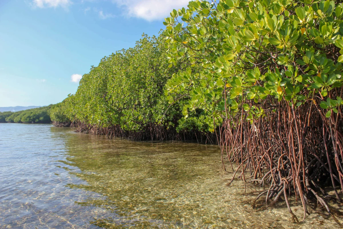
After decades of widespread environmental anxiety concerning the rapid degradation of the world’s coastal ecosystems, a breakthrough update from Global Mangrove Watch (GMW) has delivered a surprisingly optimistic assessment of global mangrove forests. Powered by cutting-edge satellite imagery, artificial intelligence, and machine learning refinements boasting an unprecedented 93% baseline accuracy, the newly released GMW 4.1 dataset documents a net global gain of 47,707 hectares in mangrove cover over the past forty years. While this milestone signals a turning point in global conservation outcomes, the data simultaneously exposes deep regional divides, pointing to severe historical losses in critical ecosystems and raising complex questions about the true ecological drivers behind unexpected coastal expansion.
A Four-Decade Chronicle of Coastal Change
The release of the upgraded GMW dataset marks a significant leap in how researchers, policymakers, and local communities monitor the planet’s dynamic shorelines. Spanning a comprehensive monitoring window from 1985 through 2025, the platform now offers baseline maps at a remarkably fine 10-meter resolution—providing six times the spatial detail of previous iterations. Furthermore, loss and recovery maps have been expanded to cover a forty-year timeline at 30-meter resolution.
This chronological expansion allows scientists to trace the trajectory of mangrove forests from an era marked by aggressive, unchecked commercial conversion—such as aquaculture expansion and coastal development during the late 20th century—to a modern period characterized by stabilizing trends, improved regulatory frameworks, and targeted restoration. Although global net figures indicate recovery, the historical timeline highlights that this aggregate number masks severe localized contractions in key tropical nations.
Statistical Breakdown: Where Forests Are Thriving and Declining
A closer examination of the GMW 4.1 data reveals stark geographical disparities between nations that have successfully expanded their mangrove territories and those that continue to face steep declines.

On the positive side, several countries have registered remarkable multi-decade gains in mangrove extent:
- Australia: +1,396 square kilometers
- India: +1,180 square kilometers
- Philippines: +473 square kilometers
- Pakistan: +439 square kilometers
- Senegal: +349 square kilometers
These gains reflect a combination of proactive government afforestation policies, successful localized community initiatives, and natural colonization along dynamic delta systems.
Conversely, other major custodian nations of the world’s blue carbon ecosystems have suffered profound net losses over the same 40-year period:
- Indonesia: -2,043 square kilometers (though metrics indicate stabilization since 2015)
- Myanmar: -1,457 square kilometers
- Malaysia: -389 square kilometers
- Nigeria: -312 square kilometers
These declines have historically been driven by a complex nexus of anthropogenic pressures—including agricultural conversion, urban sprawl, timber harvesting, and the unchecked expansion of shrimp aquaculture—compounded by climate-related stresses such as severe storms and rising sea levels.
Technological Revolution in Conservation Intelligence
The profound shift in how conservationists understand these ecosystems is anchored in the technological sophistication of the updated GMW platform. By integrating higher-resolution satellite data with advanced cloud-computing infrastructure, the tool empowers authorities to monitor remote, previously inaccessible stretches of coastline with unprecedented precision.

Lammert Hilarides, GMW Programme Lead at Wetlands International, underscored the operational significance of these upgrades. "The unprecedented accuracy of the upgraded Global Mangrove Watch is transforming our understanding of mangroves at global and local levels and revolutionizing our ability to protect and restore them," Hilarides stated. "With its unmatched data and unique alert system, this world-leading tool is now even more powerful, enabling relevant authorities, communities, and conservationists to plan mangrove activities more effectively and to react to illegal clearing as it happens—even in remote areas beyond the reach of routine surveillance."
Hilarides further noted that field managers and policymakers can now subscribe to localized deforestation alerts tailored to their specific operating zones, allowing for rapid deployment of enforcement or remediation resources before small-scale illegal clearings escalate into major ecological losses. Additionally, the latest update successfully mapped previously unrecorded mangrove areas across two new countries and four territories, bringing the total number of recognized mangrove-hosting nations and territories worldwide to 128. This expansion provides a vital baseline for small island developing states, where narrow coastal fringes play an outsized role in protecting local infrastructure and maintaining connectivity with adjacent coral reef ecosystems.
Ecological Implications: Unpacking the Drivers of Growth
While a net global gain of 47,707 hectares is fundamentally encouraging, environmental scientists emphasize the necessity of looking beyond the raw numbers to understand how and why these forests are changing.
Natural regeneration and community-based ecological restoration have undoubtedly played a major role in expanding mangrove cover. For years, the conservation sector grappled with the widespread failure of large-scale, top-down mass-planting projects that often utilized incorrect species or ignored local hydrological conditions. The latest GMW data provides empirical evidence that community-led restoration approaches—which focus on re-establishing natural tidal connectivity, repairing disrupted hydrological pathways, and fostering natural regrowth—are yielding sustainable, long-term results.
However, researchers have also identified a more ironic and potentially concerning driver behind some recorded mangrove expansions: upstream human destruction. Geospatial analysis suggests that a portion of the mangrove growth observed around major river mouths and deltas is directly linked to intense human activities further inland. Deforestation, large-scale mining operations, and intensive agriculture in river basins drastically alter sediment loads and freshwater discharge patterns. As massive volumes of eroded soil wash downstream, they deposit sediment along river deltas and estuaries, creating new mudflats and shallow substrates where pioneering mangrove species rapidly colonize. In essence, the unintended expansion of mangroves in certain zones is being subsidized by the degradation of terrestrial ecosystems elsewhere.
The Critical Need for Continued Safeguards
Despite the positive global net trajectory, experts warn against complacency. The world’s remaining 147,283 square kilometers of mangrove forests remain frontline defenses against a changing climate and foundational pillars of coastal livelihoods.
Thriving mangrove habitats provide an array of irreplaceable ecosystem services:
- Climate Mitigation: Mangroves sequester atmospheric carbon at rates up to four times higher per hectare than typical terrestrial tropical rainforests, locking away vast quantities of "blue carbon" in their sediment layers.
- Coastal Resilience: By acting as natural breakwaters, these dense coastal forests significantly attenuate wave energy, shielding vulnerable coastal communities and sprawling urban centers from catastrophic storm surges, coastal erosion, and rising sea levels.
- Food Security and Biodiversity: Mangroves serve as essential nursery grounds for a vast array of commercial fish species, crustaceans, and marine life, directly sustaining the food security and economic livelihoods of millions of coastal inhabitants across the tropics.
Safeguarding these remaining ecosystems requires shifting from passive observation to aggressive, data-driven stewardship. With tools like the upgraded Global Mangrove Watch now operational, conservationists possess the high-resolution evidence base needed to prioritize preservation zones, identify prime restoration candidates, and hold bad actors accountable in real time.
Collaborative Foundation
The continuous evolution and maintenance of the Global Mangrove Watch platform represent a triumph of international scientific cooperation. The initiative serves as the core evidence base informing the Global Mangrove Alliance and is the product of years of collaborative research involving local and international environmental organizations, academic institutions, and space agencies. Key contributors include Wetlands International, The Nature Conservancy, SoloEO, Aberystwyth University, the Japan Aerospace Exploration Agency (JAXA), NASA, the World Wide Fund for Nature (WWF), and the International Union for Conservation of Nature (IUCN). Financial and institutional backing has been generously provided by organizations such as the Oak Foundation, COmON Foundation, GreenChoice, DOB Ecology, and the Dutch Postcode Lottery.
As climate pressures mount and global sea levels continue to rise, the ability to monitor, understand, and defend the world’s mangrove forests with surgical precision will remain a cornerstone of global marine and terrestrial conservation strategy.
