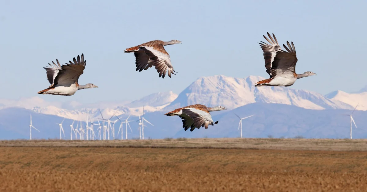
The global imperative to rapidly accelerate renewable energy deployment, crucial for averting ecological collapse driven by climate change, presents a delicate and complex challenge: ensuring that this transition does not inadvertently exacerbate biodiversity loss. A cornerstone of achieving this delicate balance lies in the strategic placement of renewable energy infrastructure. The most effective and economically viable method to safeguard wildlife, particularly birds, from the impacts of wind turbines is meticulous site selection, steering clear of sensitive species, vital habitats, and major migratory pathways. This proactive approach minimizes potential harm or renders impacts significantly easier to mitigate.
The Rise of Spatial Planning in Renewable Energy
Sensitivity maps, sophisticated spatial planning tools designed to identify areas unsuitable for development, are rapidly gaining traction among governments and the energy industry worldwide. These maps represent a critical scientific advancement, enabling developers and policymakers to make informed decisions that integrate ecological considerations from the outset. BirdLife International has been at the forefront of developing and championing these indispensable tools. Historically, the Avian Sensitivity Tool for Energy Planning (AVISTEP) was a pioneering initiative, primarily focusing on critical regions in Africa and Asia. Leveraging this foundational methodology, BirdLife’s extensive network of European Partners has since adapted and refined national sensitivity maps, incorporating localized data and specific avian ecological knowledge relevant to their respective territories.

The urgency for such tools is underscored by the European Union’s ambitious renewable energy targets. Member States are currently engaged in a race to designate dedicated Renewable Acceleration Areas (RAAs) across both terrestrial and marine environments to fast-track renewable energy projects. While these RAAs are primarily identified based on high wind or solar potential and existing infrastructure, the initial criteria often overlooked comprehensive biodiversity parameters, posing potential ecological risks. Sensitivity maps offer a crucial, science-based framework to guide Member States in strategic spatial planning, ensuring that the drive for energy independence progresses in harmony with biodiversity conservation. These maps empower planners to integrate robust ecological data into the earliest stages of decision-making, thereby minimizing negative impacts on vulnerable ecosystems and species.
Real-World Impact: Pioneering Efforts in Spain and Portugal
The practical application and profound influence of avian sensitivity maps are perhaps best exemplified by the pioneering work of BirdLife’s partners in the Iberian Peninsula.
In Spain, SEO/BirdLife has been a leading voice in the sustainable deployment of wind energy since the nascent days of wind farm development in Tarifa, within the ecologically vital Strait of Gibraltar, during the 1990s. This region is a critical bottleneck for millions of migratory birds traversing between Europe and Africa, including numerous raptor species and soaring birds. Recognizing the inherent risks, SEO/BirdLife has historically employed legal action against projects that threatened areas of high ecological value, demonstrating an unwavering commitment to protecting sensitive species. Their proactive development of comprehensive bird sensitivity maps for onshore wind, offshore wind, and solar photovoltaic installations represents a paradigm shift. By providing these detailed spatial tools, SEO/BirdLife ensures adherence to the fundamental principle of the mitigation hierarchy: avoidance of damage before it occurs. This strategic intervention has proven to be a game-changer, effectively preventing harmful developments from encroaching upon biodiversity-rich areas. For instance, the maps highlight areas crucial for species like the Rüppell’s Vulture or the Spanish Imperial Eagle, guiding developers away from their flight paths and breeding grounds. Spain, a nation committed to significantly expanding its renewable energy capacity, particularly wind and solar, relies heavily on such tools to achieve its climate goals without compromising its rich biodiversity.

Just across the border, in Portugal, BirdLife Partner SPEA (Sociedade Portuguesa para o Estudo das Aves) has powerfully demonstrated the transformative potential of robust data. SPEA’s meticulously crafted offshore sensitivity maps, which focused on 34 species particularly vulnerable to collision with turbines and habitat displacement, exerted significant influence on an already finalized national deployment plan. The data presented by SPEA revealed high sensitivity in several areas initially proposed by the government through its Marine Rapid Readiness Assessment. Consequently, one originally designated RAA, Ericeira, was entirely removed from the plan, and another, Viana do Castelo, was significantly downsized. This case vividly illustrates that while ideally, sensitivity maps should precede the declaration of RAAs, they can still be instrumental in driving critical changes and preventing adverse ecological impacts even when initial areas have been identified. Portugal, with its expansive coastline and ambitious offshore wind targets, faces unique challenges in protecting its diverse seabird populations, including species like Cory’s Shearwater and Northern Gannet, making SPEA’s maps an indispensable planning tool.
Influencing Government Policy: Success Stories in Italy and Poland
The influence of these maps extends beyond project-specific adjustments to shape national policy frameworks, as evidenced by developments in Italy and Poland, supported by funding from the European Climate Foundation (ECF).
In Italy, BirdLife Partner LIPU (Lega Italiana Protezione Uccelli) has developed avian sensitivity maps for both onshore and offshore wind, employing a clear, intuitive traffic light color system. Red indicates the most sensitive areas, signaling high risk for development, while green denotes areas of lower sensitivity. These maps are designed to be user-friendly, providing immediate visual cues to planners and developers. Crucially, protected areas are consistently marked in grey across all Italian maps, designating these zones as strictly off-limits for construction due to their invaluable ecological status. The success of these maps is already evident at the local and regional levels, particularly in regions like Sardinia, known for its high wind potential and significant biodiversity. Here, the ‘grey layer’ identifying protected areas is increasingly recognized and respected by administrative bodies, fostering a new standard for responsible development. Italy, with its diverse landscapes ranging from alpine peaks to extensive coastlines, hosts a rich variety of bird species, many of which are migratory. The integration of updated Important Bird & Biodiversity Areas (IBAs), as highlighted in the figure caption (April 2025 update), ensures these maps reflect the most current understanding of critical avian habitats.

Similarly, in Poland, BirdLife Partner OTOP (Ogólnopolskie Towarzystwo Ochrony Ptaków) has produced comprehensive sensitivity maps for offshore wind, utilizing different tones and gradings of a single color – a design choice informed by extensive consultation with national decision-makers to maximize usability. Like Italy, Polish maps clearly demarcate protected areas in grey. The effectiveness of OTOP’s maps has been further amplified through constant dialogue with governmental authorities and the business sector. This collaborative approach has paid dividends: Polish sensitivity maps have been officially recommended as a requirement in government guidelines for fulfilling the technical specifications for renewable energy mapping potential. This significant policy integration was achieved through broad consultations, including the Polish Wind Energy Association, underscoring the value placed on scientific, data-driven planning by industry stakeholders. Poland’s ambitious energy transition, particularly its focus on developing offshore wind in the Baltic Sea, makes these maps vital for protecting migratory waterfowl and seabird populations, which are abundant in this region.
Sensitivity Maps: A New Standard for Biodiversity Protection
BirdLife International and its network of Partners have solidified their position as recognized authorities in the field of avian sensitivity mapping. While other organizations are also developing similar tools, the BirdLife Partnership was among the first to drive this trend forward across numerous countries. Beyond the Iberian Peninsula, Italy, and Poland, BirdLife Partners in Bulgaria, the UK, Czechia, Hungary, Ireland, Romania, Slovenia, Croatia, Finland, and Malta have all successfully produced and continue to refine onshore and offshore wind maps tailored to their national contexts. The growing urgency to accelerate renewable energy deployment across Europe has created a strong demand for expanding these maps to additional countries, including Greece, Iceland, and Georgia, where the unique ecological landscapes and bird populations necessitate bespoke spatial planning tools.
Despite their user-friendly design, the effective application of sensitivity maps requires careful interpretation. To prevent misunderstandings, BirdLife Partners have developed comprehensive recommendations and indicators for governments and industry stakeholders on how to best read and utilize these maps. These guidelines emphasize that while maps are powerful planning tools, they are not substitutes for more detailed, site-specific environmental assessments, such as Environmental Impact Assessments (EIAs), Strategic Environmental Assessments (SEAs), or Appropriate Assessments (AAs). These more in-depth analyses remain crucial for understanding localized impacts and developing specific mitigation strategies.

It is imperative to understand that sensitivity maps constitute just one, albeit critical, component of a broader, holistic approach to minimizing negative environmental impacts. They represent the foundational "avoidance" step within the widely recognized mitigation hierarchy: avoidance, minimization, restoration, and offsetting. For nature conservation and renewable energy deployment to genuinely advance hand-in-hand, science-based solutions must lead the way in reducing biodiversity impacts. This comprehensive approach also necessitates continued innovation in technology aimed at increasing energy saving and enhancing the efficiency of renewable energy systems.
As the pace of renewable energy rollout intensifies, adherence to sound processes and protocols becomes paramount. Biodiversity and fragile ecosystems must be prioritized through strengthened strategic investments in nature restoration and a resolute political will. Governments hold a pivotal responsibility to comprehend and implement effective spatial planning and robust management of protected areas. They must create an enabling environment for developers to undertake truly "good" projects—those that not only contribute to climate goals but also enhance, or at least avoid harming, natural capital. Ultimately, safeguarding nature offers a multifaceted win-win scenario for wildlife, human society, and the energy industry, providing a sustainable pathway through the challenging yet crucial decades ahead. Sensitivity maps are an indispensable part of this journey, offering a data-driven compass to protect the avian life we cherish while building a cleaner, greener future.
